


October 4 - 9, 2021
YELLOWSTONE NATIONAL PARK
Wyoming
“Yellowstone National Park is an American national park located in the western United States, largely in the northwest corner of Wyoming and extending into Montana and Idaho. It was established by the U.S. Congress and signed into law by President Ulysses S. Grant on March 1, 1872. Yellowstone was the first national park in the U.S. and is also widely held to be the first national park in the world. The park is known for its wildlife and its many geothermal features, especially Old Faithful geyser, one of its most popular. While it represents many types of biomes, the subalpine forest is the most abundant. It is part of the South Central Rockies forests ecoregion.” Wikipedia
I visited Yellowstone with my family when I was in eighth grade. I have only vague recollections on the visit, I remember the forest, I seem to remember Old Faithful and Mammoth Hot Springs, but my most vivid memory is fainting while standing in the buffet line at the Yellowstone Lodge. I obviously want to make some lasting memories in this, the granddaddy of all parks, minus the fainting.
In July I made a week-long camping reservation for the first full week of October, hoping the crowds would not be as massive. At the time I made the reservation I checked Yellowstone’s October weather and while it said it could get cool at night, the days on average were in the 60s-70s. I thought that would be ideal. So, one week out I checked the local forecast, and while Monday and Tuesday are predicted to be nice, rain, freezing rain, and snow are predicted for later in the week. This should be interesting.
Day 1 - Monday, October 4
After a short drive from Bozeman, MT, I checked into my campground and got my RV all set up. I then headed off for my first day in Yellowstone. There was a short line of cars waiting to get passed the entry gate, which was really promising, as I was hoping it wouldn’t be very crowded. After entering on the north side of the park, the drive follows the Yellowstone River for a ways. I didn’t stop to take pictures of the river today, but there definitely will be some in the coming days. A couple miles into the park there was a pull-off and I decided to stop, not realizing until I got out of the truck that I was at a marker for the 45th Parallel - marking halfway between the Equator and North Pole.
Venturing on, I came to Mammoth Hot Springs, I found a parking spot, grabbed the camera, and headed off on the mostly wooden trail around the springs. The Coca-Cola and Oreos quickly caught up to me as I huffed and puffed while climbing the stairs, while strenuous for this old man, I kept climbing until I got to the top which made the rest of journey a little more tolerable. The springs were interesting and pretty. As I got close to my truck I noticed there were several elk grazing near the parking lot, and while there were a lot of people around, the crowd didn’t seem to phase them at all.
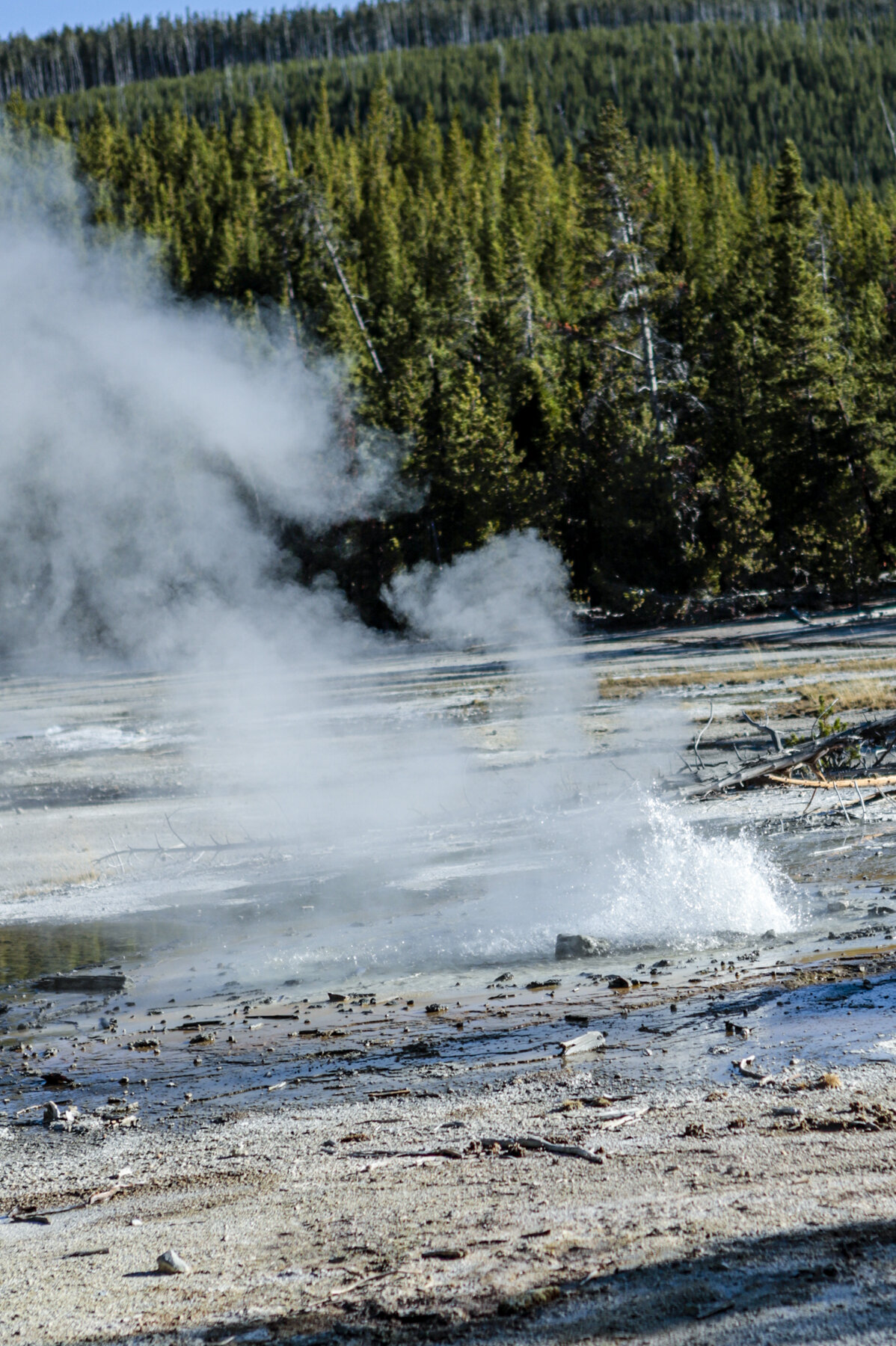
My next stop was the Norris Geyser Basin. I took the 1.6 mile Back Basin Loop Trail which went by several different geysers and springs. While none of the geysers erupted while I was there, many were active as evidenced by the amount of steam eminating out of the ground. The water color in a couple of the springs was beautiful. As I finished the trail there was another trail which led to another geyser basin…it looked interesting, but I would have to descended a hill, which would have meant climbing back up when I was finished and I had walked enough for the day. Besides, it was almost 5 o’clock, so I decided it was time to head back to the campground, which was a good 45 minute drive.
About 5 miles from the the park entrance traffic slowed, which I knew meant there must be some type of wildlife ahead, and sure enough as I got closer the beautiful bull elk with a huge rack of antlers was walking near the road. Cars were slowing, but not stopping, so I grabbed my camera and took a quick picture through the windshield.
When I arrived at the campground I found two elk laying beside the RV about five spaces from me.


The Roosevelt Arch


Travertine hills at Mammoth Hot Springs

Mammoth Hot Springs

Mammoth Hot Springs

Mammoth Hot Springs

Not sure the name of this small lake, but found the water color change in the middle of the picture interesting.

Roaring Mountain

Emerald Spring

Steamboat Geyser - World's tallest active geyser. It has unpredictable, infrequent major eruptions of more than 300 feet.

Crater Spring

Water flowing from different geysers in the Back Basin area of the Norris Geyser Basin.

Porkchop Geyser
Minute Geyser - "Minute Geyser's eruptions have changed dramatically. Its larger west vent is clogged with rocks tossed in by early visitors when the park's main road was near this trail--passing within 70 feet of the geyser. Minute once erupted ever 60 seconds, sometimes to heights of 40 to 50 feet. Eruptions now are irregular and originate from its smaller east vent."

A view of the Porcelain Basin of the Norris Geyser Basin.

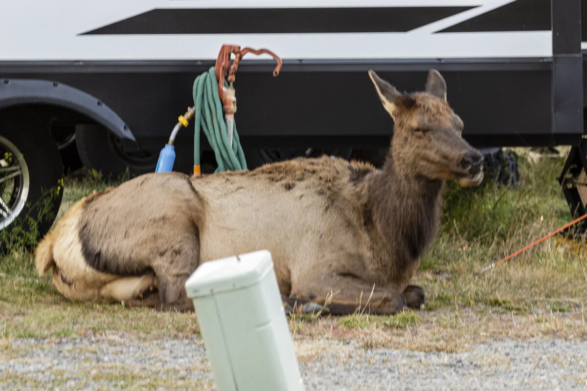
The elk next to an RV about three spots from my RV.
Day 2 - Tuesday, October 5
Got kind of an early start this morning, entering the park at 7:45 a.m. Just before reaching Mammoth there were some elk grazing alongside the road, so I pulled into a turn-off and shot some pictures. When I started driving again, I went about 0.25 mile and a good-sized elk came out of nowhere to cross the road in front of me, I slammed on my brakes, which sent everything in my passenger seat, including both cameras, flying onto the floor. But I didn’t hit the elk. I stopped at the next turn-off and got myself and all my things put back in order.
When I got to Mammoth the sun was hitting the hot springs making them really stand out, so I pulled into a parking lot to snap a couple pictures. Soon I heard the bugling of what I assumed was a bull elk. I started searching the hills for signs of him and saw some females, then just across the road I saw some commotion, and there he was, a beautiful bull elk, who followed a female across the street, bugling all the way. There were several people gathering to take pictures of him, and when he stopped and stared at us, most of us sought safety, mine was my truck.
From there I started driving a big loop in the park, stopping at interesting places all along the way. I saw many geysers and springs, including Old Faithful. I stopped at three different waterfalls which were beautiful, if only I would have timed my stops so the light would have been better (hopefully, return trips in the future). I about killed myself at the Brink of the Lower Falls, when I thought I overheard a gentleman tell some others that the trail wasn’t that bad. 3/8 of a mile and a descent of 600 ft later I was overlooking the falls. I probably would have enjoyed the views better if I wouldn’t have been worried about walking 3/8 of a mile and climbing 600 ft to get back to the top. The falls were at the beginning of the Grand Canyon of Yellowstone, which was breathtaking.
I was in the park for about 11 hours. It was a great day, and I now have a list of places I want to go back and spend more time at.

The bull elk, bugaling.

Mammoth Hot Springs

It was a cold morning (31°F) as I approached the Artists Paintpots.

A mudpot at Artists Paintpots

The Gibbon River

Gibbon Falls


Old Faithful, about an hour before erupting.

The crowd waiting for Old Faithful to erupt. I can't imagine what the crowd must be like in July and August.

Old Faithful

Old Faithful

Blue Star Spring

The Firehole River

Double Pool

There are many unnamed geysers and springs.

The Continental Divide weaves its way through the park.

Isa Lake stradles the Continental Divide. "As spring runoff empties into Isa Lake, the water swells and overflows its tiny borders. When this happens, the lake dos something extraordinary. Not only does it empty into two oceans, but it does so backwards. The east drainage flows into the Pacific, while the west drainage makes the long trek to the Gulf of Mexico."

West Thumb Geyser Basin on the shore of Yellowstone Lake.
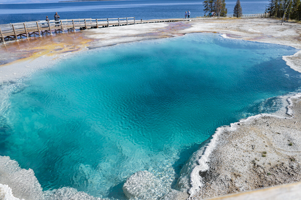
Black Pool. Notice the drainage area marked by the colored area near the top of the picture.

The Black Pool drains into Yellowstone Lake.

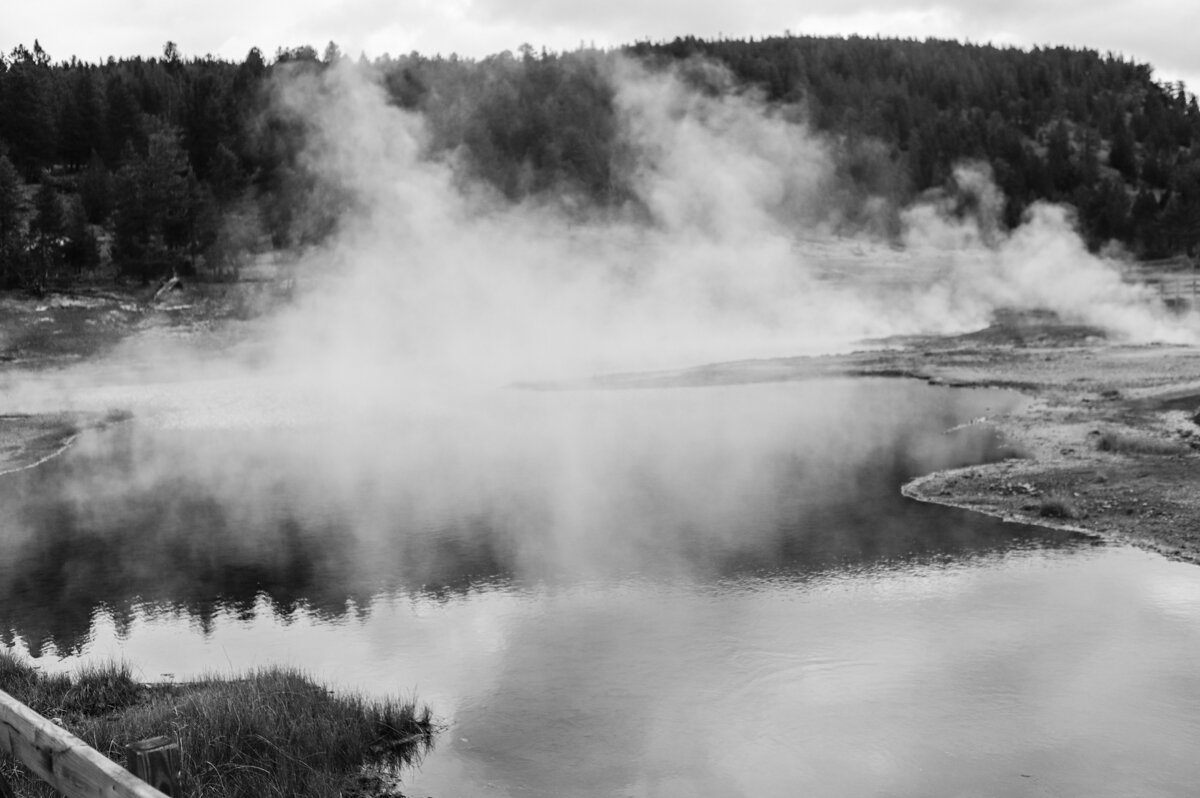
Winter Spring

Mud Volcano - was found erupting in 1870. Two years later it was a pool of bubbling, muddy water, as it is today.

Dragon's Mouth Spring, aptly named. Wish I would have gotten a better picture, or some video.

Found the grasses in the water from Dragon's Mouth Spring very colorful.

Lower Falls on the Yellowstone River as seen from the South Rim.

Upper Falls on the Yellowstone River as seen from the South Rim.

The trail to the Brink of the Lower Falls on the North Rim. The trail is 3/8-mile long and descends 600 ft (approximately 42 stories). There were 10 switchbacks like the one in the picture. The climb up was a challenge for me.

The Brink of the Lower Falls.

The Grand Canyon of the Yellowstone.

The Lower Falls as seen from the North Rim.

The Grand Canyon of the Yellowstone.
Day 3 - Wednesday, October 6
Decided to take it a little easier today, entered the park around 9:30 a.m. When I got to Mammoth Hot Springs I turned and took the road to the Northeast Entrance which, because of road construction, I knew was going to be a one-way trip out and then turning around driving the same route back. The route would be 47 miles out, and tehn 47 miles back, but I had read this was the route I wanted to take if I wanted to see wildlife.
My first stop was the Urdine Falls. According to the map my next stop was going to be Wraith Falls, just a short drive from Urdine Falls, but when I got to the Wraith parking lot it was full with people standing with binoculars and telescopes looking north. I’m pretty sure these people were scouting the moutain sides looking for bears or wolves, so I drove on. I then stopped at Forces of the Northern Range trail, a boardwalk trail with signs explaining the landscape and wildlife of the area. In spite of it being mostly cloudy, the landscapes were beautiful.
Feeling adventurous, after seeing a road sign, I made a split-second decision to take the Blacktail Plateau Drive, hoping it might take me to a spot with a spectacular view of the area. The “road” was a six-mile, one-way, unpaved (meaning very rough rock), winding road. I was thankful I was in my 4-wheel truck built to handle this terrain. When vehicles came up from behind I found areas where I could pull over and left them pass, sometimes I shook my head with how fast they were travelling on this rough road. It was almost 5 miles into the road when I finally found an area I could pull over and take a photo of the area, and it wasn’t really that great of a vista. The excursion was worth it when just before coming to the end a black bear was wandering on the hill.
After getting back on the main road, I soon entered the Lamar Valley. Soon, traffic was pulling over due to a heard of bison. Having not taken any pictures of bison in Yellowstone, I decided I should stop. To my thrill there were four pronghorn wandering in the area. I have developed a love of pronghorn, they are beautiful and graceful, and very fast.
On the rest of the trip to the Northeast Entrance and then back to Mammoth, I stopped at different places to take pictures of the beautiful landscape. Picture stops included Pebble Creek, Wraith Falls, and the Yellowstone River. When I returned to the campground I was greeted by six elk grazing and lounging near the restroom. Later in evening campers were entertained as the elk made there was through the campground. The obviously have been here before and were not skiddish around people.

Urdine Falls

Urdine Falls


A view along the Blacktail Plateau Drive

The Blacktail Plateau Drive

Black Bear
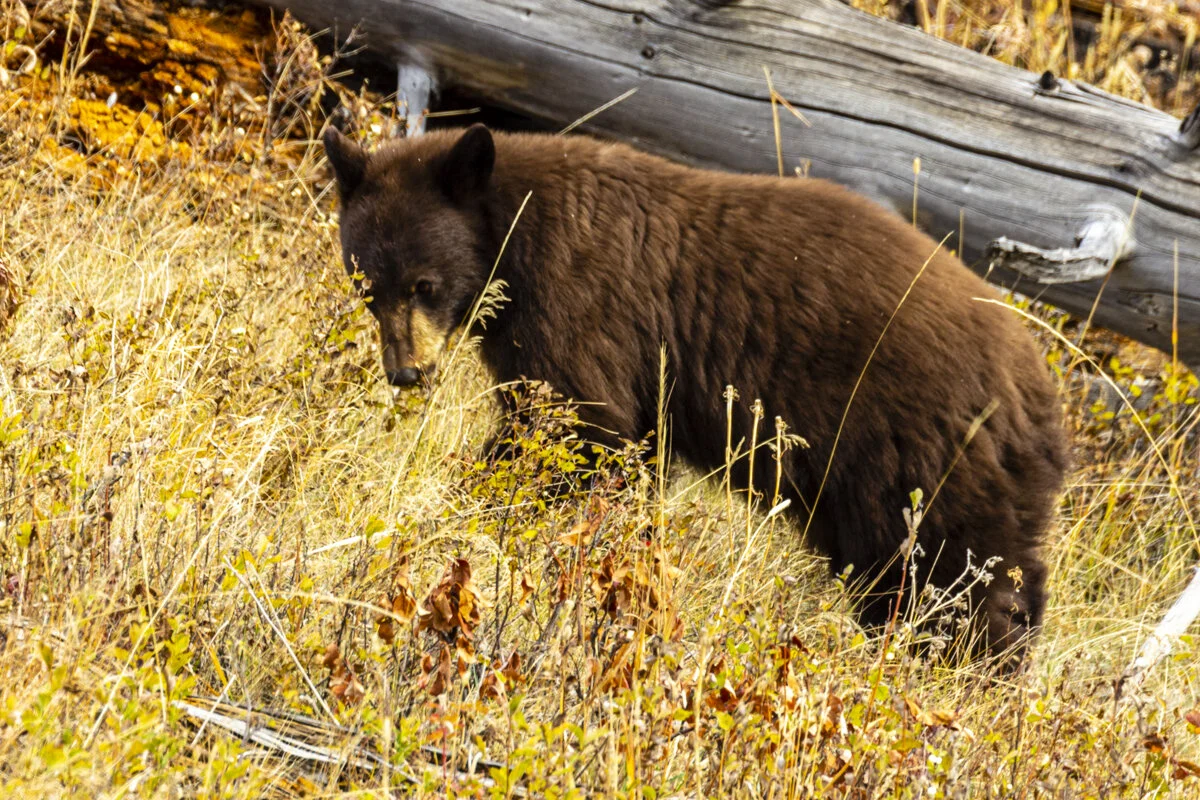
Black Bear


Some pronghorn near a bison heard.


The pronghorn got spooked and took off running. Beautiful.

When the pronghorn got into some thicker brush they stopped to check things out.

Love the views in the Lamar Valley. The dark spots in the picture are bison.

Pebble Creek

Pebble Creek

A panorama of the scenic landscape.

The Yellowstone River

The creek below Wraith Falls
Wraith Falls

The Yellowstone River near the North Entrance to Yellowstone National Park.

The Yellowstone River near the North Entrance to Yellowstone National Park.

The Yellowstone River near the North Entrance to Yellowstone National Park.

The Roosevelt Arch.

The elk back at the campground.

The Yellowstone River runs alongside the campground.

Elk outside my RV.
Day 4 - Friday, October 8
After not visiting the park yesterday so I could finish up things around the RV and run a couple errands, I set out mid-morning to check out the park on this dreary day. I had one goal, to visit Grand Prismatic Spring, which I had to skip on Tuesday because the parking lot was completely full. Other than that I thought I would check out some of the other things I missed on Tuesday. Because of the forecast of showers I wasn’t sure what I would get to see or do.
I wish I could have captured the clouds intermingling with the tops of the mountains, but I will have to work on that skill. I took the Upper Terrace Drive of the Mammoth Hot Springs, and then made my way further into the park. I stopped at Gibbon Falls again, and it appeared to me that there was more water coming over the falls, but it may have just been my imagination.
Not too far past Gibbon Falls I saw a sign for the Firehole Canyon Drive and decided to take it. I’m so glad I did. The Firehole River is beautiful in this area, and the Firehole Falls were spectacular. The next stop was the Midway Geyser Basin, home of the Grand Prismatic Spring. This spring is probably the most well known, and colorful spring in the park. The crowded parking lot is a testament to its popularity. Luckily, a car pulled out just before I completed the parking lots circle drive, so I parked. As I was walking the boardwalk trail steam from the geysers and springs in the area fogged up my glasses. The steam was so thick it was hard to see people coming towards you. The first stop was at the Excelsior Geyser Crater. While it was hard to see the whole geyser, once I got upwind I could see the rich colors of the water. The trail then proceded to the Grand Prismatic Spring, which like the Excelsior Geyser, was hard to see because of all the steam. A young man back at the campground had warned me this could happen and told me about a observation deck along the Ferry Falls Trail nearby, which would give me a better picture of the spring. The observation deck was 0.8 miles from the trailhead. The trail was fairly flat until the last 100 yards, but the climb proved successful with a better view of the spring.
I stopped at a couple other geyser basins, where I was able to capture a couple small geysers erupting, before heading back to the campground. Despite the off-and-on showers and just generally dreary conditions, it turned out to be a fairly successful day.


A dreary day on the Upper Terrace Drive made me want to make this a black-and-white photo.

Mammoth Hot Springs and the clouds intermingling with the mountain tops in the background.

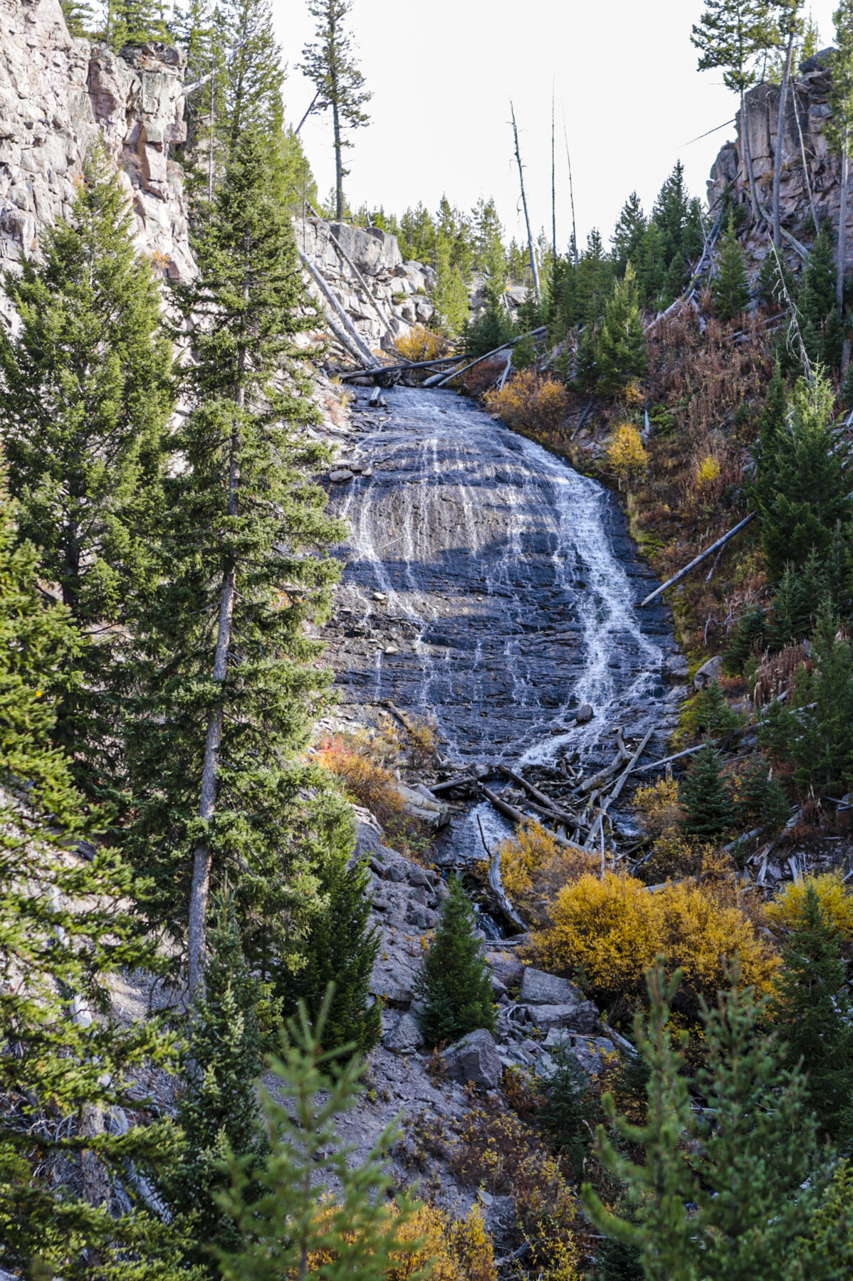
A waterall not too far outside Mammoth Hot Springs. It is right alongside the road. I had stopped a couple of time where the couple is standing and didn't know a falls was near.
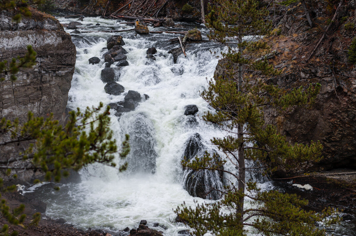
Firehole Falls

The Firehole River below the falls.

Firehole Falls

Firehole River a ways up above the falls.

The Firehole River

Gibbon Falls

Gibbon Falls

Water from the geysers and springs in the Midway Geyser Basin running into the Firehole River.

A part of the Excelsior Geyser

The Grand Prismatic Spring as seen from ground level.

The Grand Prismatic Spring as seen from ground level.

Grand Prismatic Spring as seen from the observation deck on the Fairy Falls Trail.

Grand Prismatic Springs as seen from the observation deck on the Fairy Falls Trail. This picture was taken with my iPhone.

A bison in the vicinity of two different geyser basins. My assumption is that he has rolled in the ground near a geyser.

One of the streams of water running from geysers in the Biscuit Basin to a nearby creek. The color just fascinates me.

The Sapphire Pool in the Biscuit Basin.

Jewel Geyser erupting in the Biscuit Basin. The water shot about 8 feet in the air.

This is Jewel Geyser two minutes after it erupted.
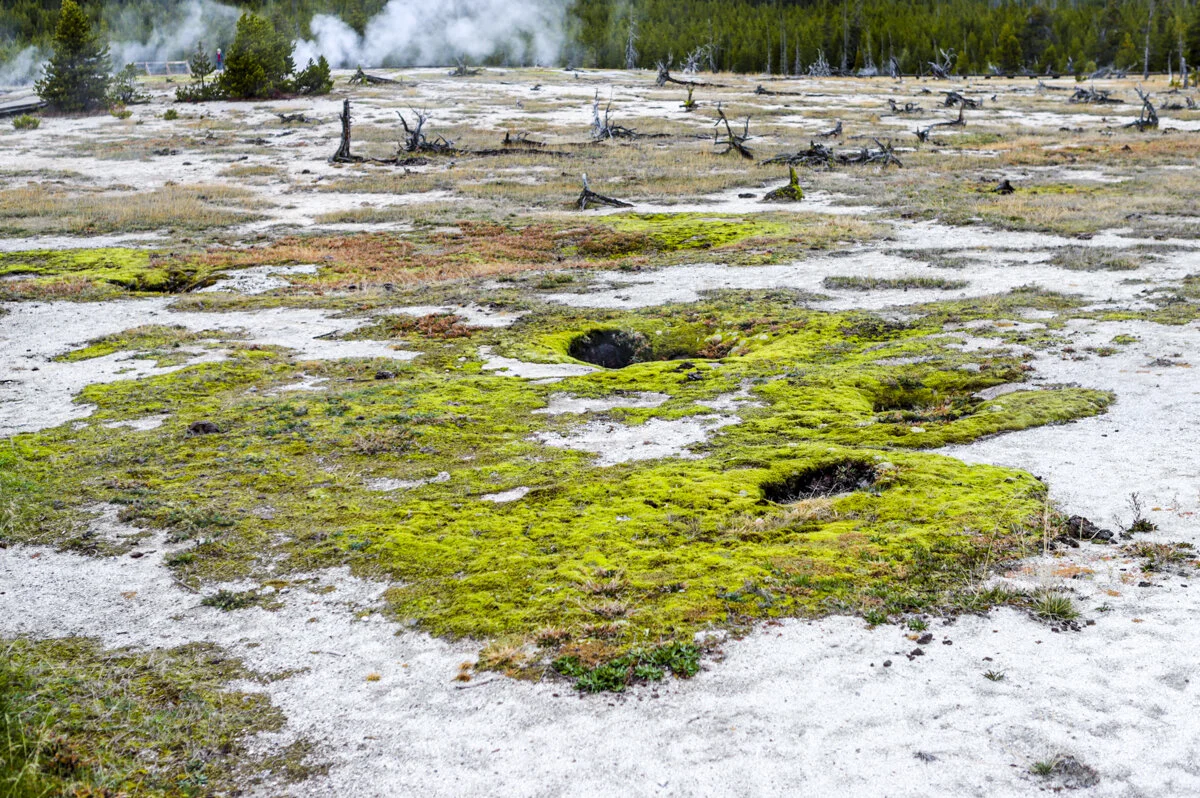
I was fascinated by how there is a lot of dead trees around the geysers, but then there would be these colorful areas of green growth.

Avoca Spring

Not sure the name of this spring (or geyser), but I really liked the colors, though they really don't show up in the picture.

This is an area of bacterial growth near one of the geyser. Very colorful with interesting patterns.

Wall Pool in the Biscuit Basin.

The White Dome Geyser along Firehole Lake Drive. I stopped because I thought this geyser was unique. As I was photographing it a lady standing nearby said it was about to erupt. I thought she was crazy.

And then it erupted.

The White Dome Geyser grows larger each time it erupts as minerals in the water be expelled stick to the outer shell and make it grow.

Firehole Lake
Same pic, only in black-and-white. Some of these scenes would make awesome horror movie sets.

The Young Hopeful Geyser. Love the name!
Day 5 - Saturday, October 9
Woke to raindrops hitting the roof of the RV. Remembering an adage my father used to quote, “Rain before 7, shine before 11,” I got up and lounged around hoping the rain would stop. I decided I would skip going into the park unless the rain stopped. Around 11 it was still cloudy with on-and-off showers. Decided to put this down time to use and use the campground’s laundromat to do a couple loads. On my way back to the RV after starting the laundry the sun broke through the clouds. When the laundry was finished I grabbed my camera and headed into Yellowstone for the last time on this trip.
My plan was to head over to the Lower Falls and Upper Falls on the Yellowstone River. I decided to take the Upper Terrace Drive through Mammoth Hot Springs again. It was considerably more congested today, which I guess shouldn’t have been too surprising since it is Saturday. After snapping a couple pictures I took off for Norris. As I drove I noticed the mountain tops in the not so distance has snow on them, they didn’t yesterday.
The closer I got to Norris the cloudier it got, soon a light mist was hitting the windshield. About 5 miles outside of Norris it started to rain, at times it almost appeared to be sleeting, traffic slowed way down. It was at that time I decided to abort my mission, turn around, and head back to the RV. As I got closer to Gardiner the clouds broke up and I again saw sunshine.
Monday’s weather forecast for Gardiner is 3-5 inches of snow. I don’t want to deal with pulling a fifth-wheel trailer in wintry conditions, so I am leaving a day early when the forecast is for partly sunny and 50°. Yellowstone has been an amazing experience. I want to come back soon.

Along the Upper Terrace Drive of Mammoth Hot Springs.

Along the Upper Terrace Drive of Mammoth Hot Springs.
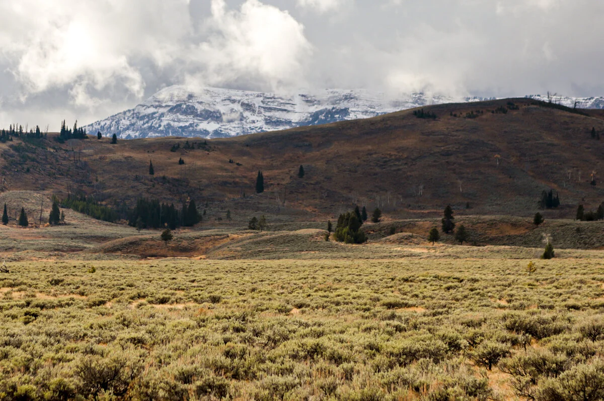
Snow on the mountain top on the drive to Norris. The snow wasn't there yesterday.

The Yellowstone River

The road near the north entrance of Yellowstone, next to the Yellowstone River.